Coastal Campout Along Highway 1
The Outs- Ellen Jo Roberts
The Noise
September 2010
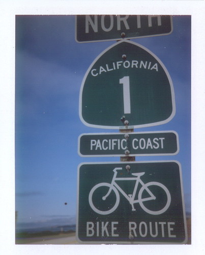
California’s Highway 1 is just a road, just a narrow curving ribbon of macadam perched along the western edge of the USA. It’s also something legendary, lyrical, mythical, magical: from books, magazines, movies and commercials.
A National Scenic Byway, it’s been designated an “All American Road”.
We all dream of Highway 1, as part of our collective consciousness.
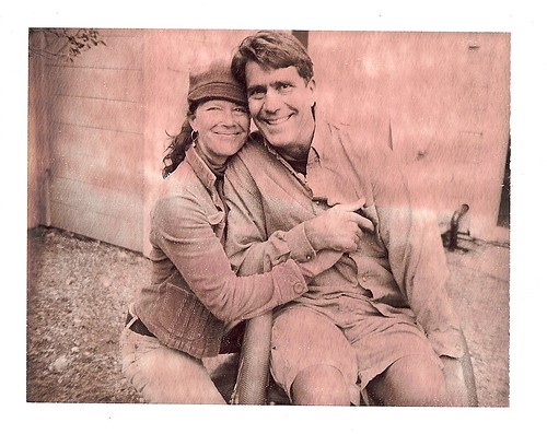
My husband and I celebrated our 15th wedding anniversary this summer, a milestone worthy of a special road trip celebration. We wanted to be part of the dream, so we planned a Highway 1 adventure. All year we poured over library books, maps, brochures, Google Earth, and the state park websites, plotting our journey, booking our reservations. For Chad, the planning part is sometimes even more exciting than the trip itself. For months he lay awake in bed at night, satellite imagery dancing in his head.
We travelled on the cheap, loaded up with camping gear and a picnic basket full of dry goods. Our only “luxury” was renting a Toyota Prius for its excellent fuel economy (averaging 50+ mpg), lower environmental impact, and modern comforts like satellite radio, climate & cruise control. We do all our longer road trips like this. Renting a car conserves both our vintage Volkswagens and our marriage.
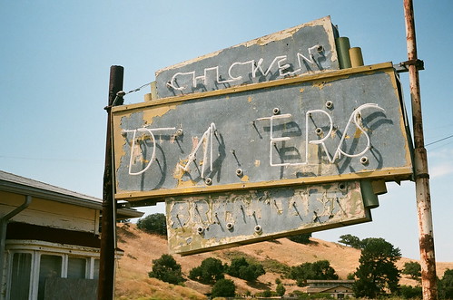
The scenic routes Chad chose were both more direct, and more time consuming. After our first 13 hours on the road, we arrived in San Luis Obispo County, in a seaside town called Avila Beach, where we set up our tent after dark, at an area campground. The next morning we were up early, making our first memories of Highway 1, via San Luis Obispo. “SLO” as the locals call it, is hopelessly adorable, chock full of tidy Mediterranean bungalows and well-groomed yards. It’s home to California Polytechnic State University (“Cal Poly”), and the delightfully tacky 1950s “Madonna Inn”, with its outsized pink sign, and crazy gingerbread flourishes.

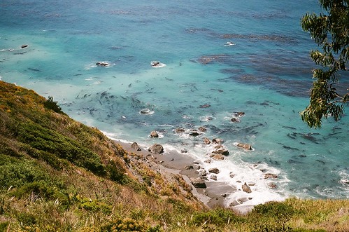
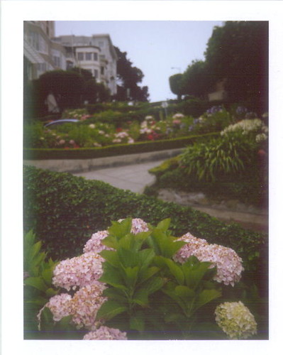
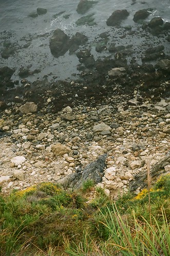
Highway 1 through the central California coast is one of the rare things that lives up to the hype. You fear a collision from gawking at the scenery. It’s also achingly slow moving, constantly curving, elevating, and bound to cause moments of nausea in even the sturdiest passenger. It is riddled with delightful pull-offs and scenic overlooks. The ocean on a cloudy day is grey, but when the fog lifts the water changes color to an unbelievable turquoise, with tangled forests of kelp floating offshore like vegetable soup.
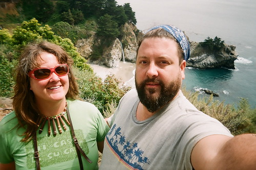
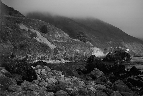
Big Sur, from “El País Grande Del Sur” (big country to the south), a moniker given by Carmel’s early Spanish settlers, remains fairly remote and sparsely populated. Highway 1 wasn’t completed through the area until 1937, and electricity didn’t arrive until the 1950s. Vast stretches are unpopulated, and the mountainous terrain to the east is Los Padres National Forest. The area is historically wealthy with inspiration for photographers, artists , beatniks, poets, writers, and other free spirits escaping from large cities to the south and north.
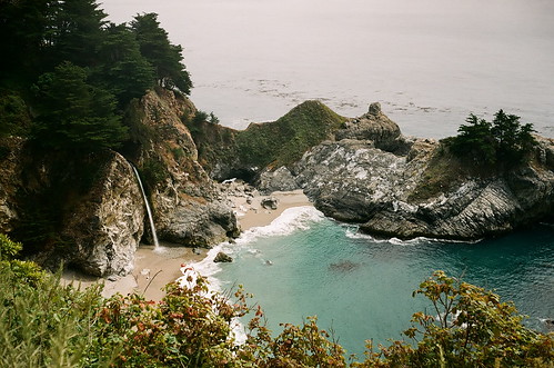
"McWay Falls” is an icon of Big Sur, a t-shirt emblem just like the Bixby Bridge further north. Located near Julia Pfeiffer Burns State Park, the waterfall tumbles west of Highway 1 onto a secluded seashore, sheltered in a stone cove. The only creatures on the beach below it were seagulls. It’s off limits to humans, though a boardwalk above allows views of the beautiful scene.
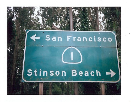
A few hours north on Highway 1, with every mile taking twice as long as we’d planned, we headed east to the quicker 101 to make up some speed to our next destination, San Francisco. It was nearly sunset by the time we arrived in the foggy city by the bay. Even the dreary weather couldn’t dim its loveliness, all vertical and cascading down hills in vintage perfection.
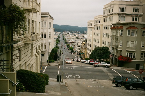
Cold in July, with everyone was wearing sweaters, coats and hats, I kept thinking of Mark Twain’s joke :” The coldest winter I ever spent was the summer I spent in San Francisco.” Perhaps it was a culmination of a long day of driving, the maps strewn everywhere in the cramped car, Chad arguing with the GPS lady-- I dunno-- but I burst into tears driving down famously steep Russian Hill. I was so scared!
We’ve driven on some hair-raising mountain roads before, crawling boulders in the wilderness, but nothing has ever frightened me as much as Lombard Street in San Francisco. I’m no “Bullitt”.
There are stoplights at the top of a 45 degree hill. There are points where you cannot see the road above/ below you and you must just have faith there is nothing in your way as the light turns green. And if your car isn’t in great shape- if the engine is weak or the brakes are bad-- you’d better just go home.
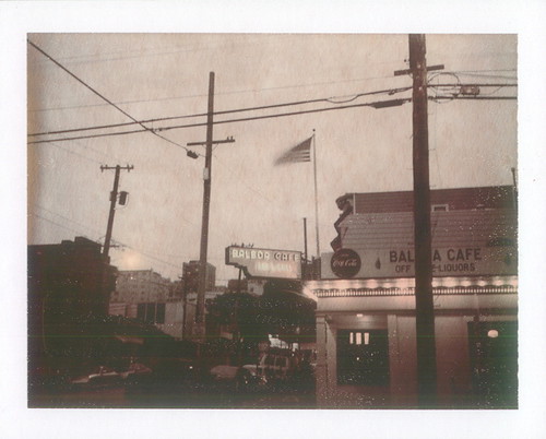
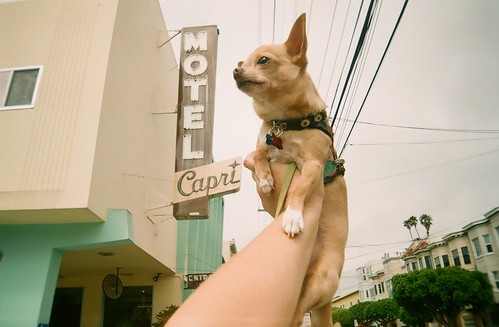
Our San Francisco night was spent at the Motel Capri, an inexpensive mid-century gem located in the Marina District, close walking distance to many interesting street scenes.
Time in San Francisco was too short: just a night and part of the next morning-- not nearly enough to soak up this vibrant city. Hiking up the steep streets on a Sunday morning with all of my cameras clattering, I was grooving on the big city life, being just a face in the crowd, one of many. No one batted an eyelash at me (unlike in my own tiny town where I am a featured landmark.) San Francisco is a smart, wealthy city, beloved by many who’ve left their hearts there. The streets are so steep it’s a full-on cardio work out all the time. A friend of mine lived there for 7 years and says, “Try walking up and down those hills every day, yeesh! I ended up in Delaware - flat as a pancake. To paraphrase Tony Bennett ‘I Left My Girlish Figure in San Francisco.’"
From San Francisco we crossed the Golden Gate Bridge north to Marin County, to have lunch with a dear favorite friend, an Arizona ex-patriot. She and her surfer beau live in a cozy 1910 built "love shack" near the sea in tiny Stinson Beach, and invited us to stay.
We cancelled our camping reservations at Manresa Beach State Park near Santa Cruz in favor of setting up tent in their garden amidst their surfboards, nestled between the fog-shrouded Mt. Tamalpais, “Birthplace of Mountain Biking”, and the cold grey waves of the Pacific.
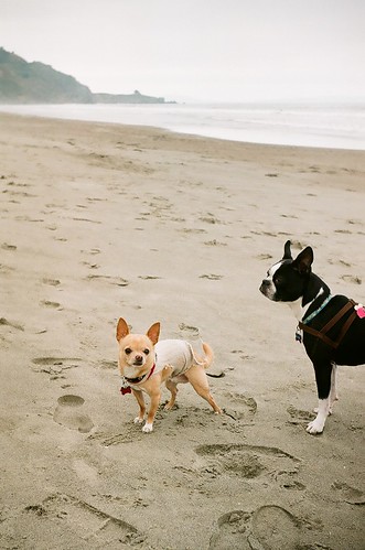
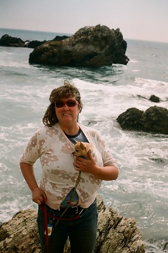
Marin County is notoriously suspicious of outsiders. Nearby Bolinas is famous for removing their city sign, to discourage tourists. Hanging with the locals we were instantly accepted as locals by proxy. Romping and running wild with our dogs on the beach was a thing of pure joy. Our friends cooked us a wonderful dinner, we drank wine, laughed, and told stories well after dark. It was a highlight of our trip and finally felt like the vacation had begun.
Highway 1 north of San Francisco is fragrant with eucalyptus. The giant groves of quick growing Australian trees are not native, and have their detractors for this reason. Despite this, the willowy giants have somehow become synonymous with California. The gold rush and railroads brought the species here in the 1850s, when the state government authorized and encouraged their quick growing establishment. The astringent smell of the eucalyptus fills our noses.
Suddenly we are in love with this part of California. My mind wanders back to the beautiful eucalyptus tree we already have, in our own Arizona front yard.
Our next campsite was back down the coast at San Simeon State Park, followed by a night at Pfeiffer Big Sur State Park. We’d reserved all of our campsites months earlier, most of them at state parks for about $40 per night.
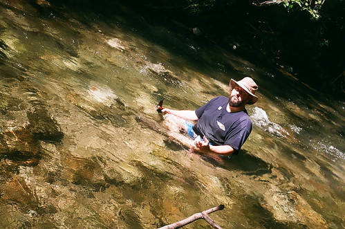
Pfeiffer Big Sur, a popular park since 1933, is a bit magical, nestled into the redwoods, and delineated by the clear grey green Big Sur River. There were swarms of ladybugs everywhere when we arrived. I wouldn’t have been surprised at all to see a unicorn.

Side note: They sell beer (!) at California State Parks. (Hey Arizona State Parks, ya’ listening?) After setting up tent it’s customary to take a dip in the Big Sur River. Hot, sunny, drinking beer in the river—just like home.
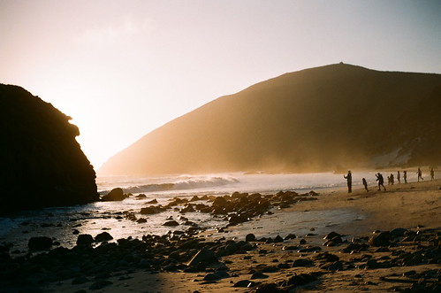
Chad led us on a sunset expedition to nearby Pfeiffer Beach. Amazing, framed by giant sea bound monoliths, and smooth purple sand, Pfeiffer Beach was blustery cold, full of photographers, picnickers sipping red wine, unruly dogs, and loud crashing waves.
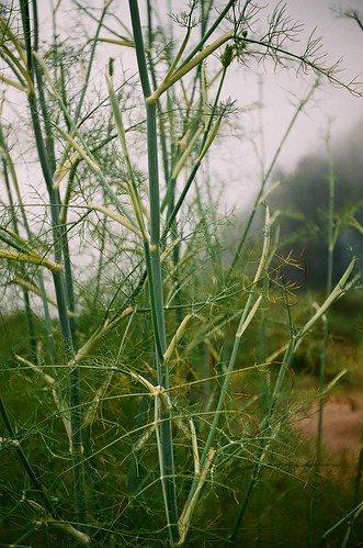
Our final night on the Big Sur Coast was spent at Kirk Creek, a federal campground. There are world-class resorts all up and down Big Sur, each charging hundreds of dollars a night. None would compare to this $22.00 campsite. When we arrived, our jaws dropped. Site #11 at Kirk Creek was the best campsite we've ever had in our lives: big, beautiful, carpeted by soft grass, high on a bluff overlooking the sunny Pacific, surrounded by sweet scented wild fennel, sage, and yarrow. A steep trail leads down to the rocky shore below.


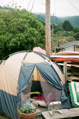
Unpacking, setting up, breaking down, and repacking camp every day was hard work. The Prius was so small we basically had to unload the entire car, and reload the entire car every day. Thank God for Chad's engineering-style mind. The camping life is hard work, toting water, lifting gear, washing dishes outdoors, washing our hair in sinks—everything takes more time and energy.
And somehow, the food tastes better. The sleep in the tent is more restful.
The hard work makes everything more valuable somehow.

Without showers for days, we were kinda’ grungey, with our rock star hair and dirty feet like a couple of goddamn hippies. It didn’t bother me at all, until we took the dogs for a stroll through a field of tall dried thistle, just north of nearby Sand Dollar Beach. Headed to a special seashore Chad selected, I looked down at the dogs and noticed little dark dots all over them. Yanking my chihuahua up by his harness, my fears were confirmed. Ticks! The dogs are covered with ticks!! Panic sets in and a shriek wells in my throat. I start brushing them off of him frantically, brushing them off my bare legs, and looking for the nearest exit. Sitting on a barren bluff, high above the rocky beach, socked in with raging high tide, I managed to clear all the ticks off of Floyd, because they are easy to spot in his pale fur. Ivan, the Boston Terrier was not as lucky. We manage to find most of them in his dark brindley fur, but miss the final two until the next day.
That night I feel itchy all over, and wish for a shower.
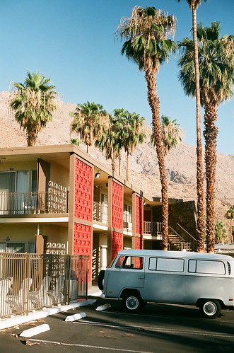
Away from the sea and back to the desert, we spent a night at a 1950s built motel in Palm Springs. San Francisco in July is cold enough for polar fleece. Palm Springs in July is like a blast furnace. It was still over 100 degrees when we rolled into town at 9pm, and already back up to 109 by 9am the next day.
Travel tip: Palm Springs motel rooms are cheap in July.
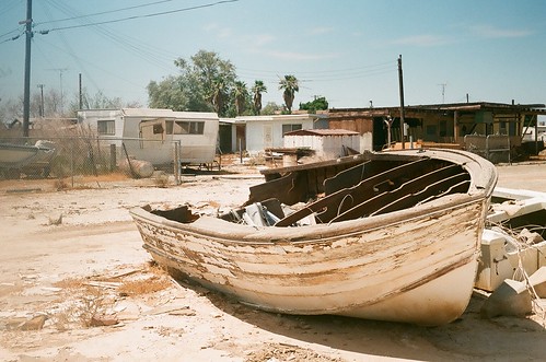
"Salvation Mountain", about 75 miles from the Coachella Valley in a remote sun-baked location near Niland, has been on my list of places to see for years. Our last day on the road, we head a lil’ bit out of our way down to see this amazing bit of folk art. The Colorado Desert sits below sea level, and is sparsely occupied during the summer. Bombay Beach along the Salton Sea is a 1960s resort town gone wrong, a post-apocalyptic paradise full of bombed out trailers and land locked boats.
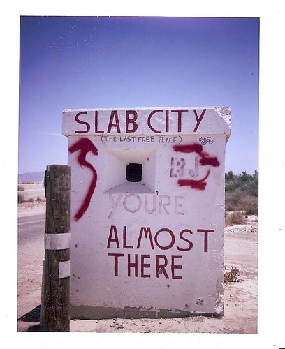
Further south is “the last free place”, Slab City, a transient community setting up camp on concrete slabs left behind from a World War 2 military installation.
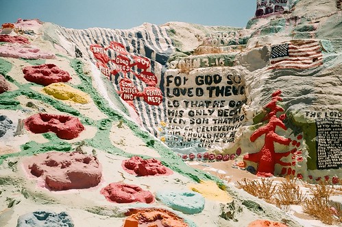
We arrive at Salvation Mountain, a massive bit of crazily colorful religious folk art created by Leonard Knight. Mr. Knight, 78, has spent decades carving and coating the side of a dirt hill with adobe, straw, thousands of gallons of donated paint, and various versions of “God is Love”, scripture, and testimony to Jesus.
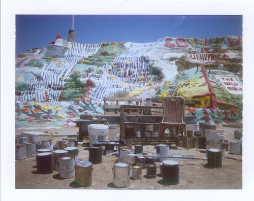
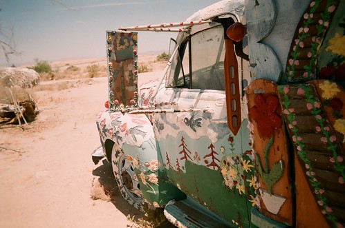
Everything is fancifully painted: cars, trucks, bikes, boats. 113 degrees at high noon. I thought my Chuck Taylors might melt. Salvation Mountain was worth the many out-of-the-way miles. It is a true thing of beauty, and as important to American iconography as Highway 1.
Driving through the heat of day, we arrive back in our neighborhood by dusk.
The Verde Valley always looks really good after a long road trip, after driving through many random small towns of assorted quality.
“You know something, this place we live in is pretty damn good. It looks pretty great here.” Back at home we feel exhilarated, relaxed, as we pour over Polaroids, tip back cold California beers, and sit close to the eucalyptus tree.
http://www.madonnainn.com/index.php
http://www.sfmotelcapri.com/
http://www.parks.ca.gov/
http://bigsurcalifornia.org/
http://www.salvationmountain.us/
Ellen Jo Roberts lives in a historic brick bungalow in Clarkdale Arizona, with Bike Daddy Chad, 2 small dogs, a cat, and a collection of vintage Volkswagens, none of which have cruise control, air conditioning or satellite radio.
Read all about it at ellenjo.com